
Your Questions, Answered
-
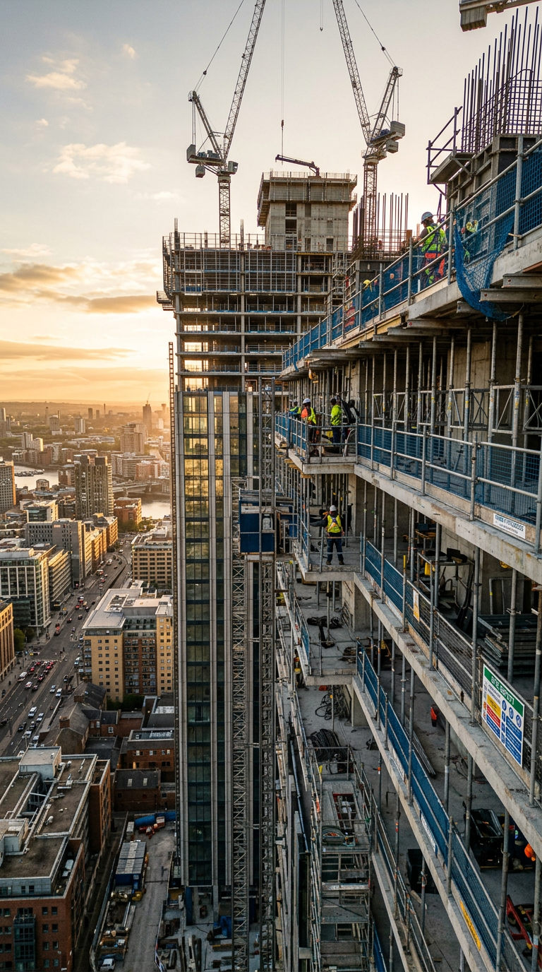
Armwings Drone delivers professional aerial data and visuals for construction, property, and infrastructure projects.
We provide construction mapping, inspections, tower inspections, 3D models/digital twins, volumetric measurements, and professional aerial photography and video.
-
-
We focus on how the work is done, not just what is delivered.
We deliver safe, well-planned drone operations with clear communication and reliable, decision-ready data. It’s not just what we do — it’s how we do it.
-
Yes. Our specialized drones with advanced sensors can safely navigate indoors to create smooth fly-through videos — perfect for showcasing real estate listings or interior layouts.
-
Pricing is flexible and based on the type and complexity of the project.
We offer flexible pricing based on project scope and complexity. After an initial discussion, you’ll receive a clear, transparent quote with no hidden costs.
-
For safety reasons, we don’t fly in rain, snow, or high winds. If weather conditions are unfavorable, we’ll reschedule your flight at no extra charge.
-
Because professional results, legal compliance, and safety matter.
Armwings Drone Services delivers FAA-certified, professional drone operations using advanced equipment and proven methods to ensure safe, compliant, and accurate results every time.
-
Yes. Drone services are legal when operated by an FAA Part 107–certified pilot and flown in compliance with FAA regulations,
-
FAA Part 107 certified pilot
This is the FAA license required for commercial drone work
Line of sight
Pilot must be able to see the drone with their own eyes
Altitude limit
Maximum height is 400 feet above ground
Airspace rules
No flying in restricted or controlled airspace without authorization
-
· As professional drone operators, we strictly follow privacy and data protection laws.
· All collected data, imagery, and reports are kept secure and confidential.
· Access is limited only to authorized clients.